Map Action Controls
This section details the map action controls, placed above the map in the top right corner of the page.

Map Action Controls
Zoom
The two top buttons (+ and -) allow to zoom-in or zoom-out the map.
Ruler
The bottom button provides a ruler.
Once clicked, select two consecutive points on the map to get distance and bearing information between those two points.
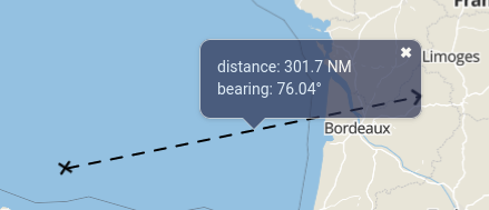
Ruler
ETA
If the clicked starting point contains a ground_speed information (typically a vehicle), an ETA will be added to the displayed info, based on the current ground_speed value of the vehicle.
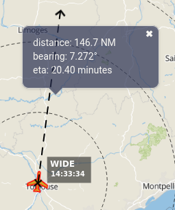
Ruler with ETA
If the starting point is moving, the ruler with be dynamic and the information will be automatically updated.
Rotation
On tactile devices, another icon may appear under the ruler if the map has been rotated.

Rotation
When click, the map will automatically rotate with the North being upward.